News & Resources
QUEENSLAND - GOOGLE EARTH VEGETATION MAP
Save this file to your computer and open on Google Earth.
![]() QLD Vegetation Management Map276 Bytes
QLD Vegetation Management Map276 Bytes
If you don't have Google Earth, you will need to download it online here. There is a free version available. Once you have downloaded Google Earth and set it up, you can "load" this QLD Vegetation Map by selecting File > Open in Google Earth and locating your file on your computer. Zoom into Queensland. You will be able to view different areas / zones by ticking or unticking the tickboxes in the "Layers" column.
If your map becomes too busy with data, simply "untick" different boxes/layers (including default data like photos, roads etc).
DOWNLOADS
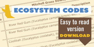
An easy to read version with vegetation common names, specific to Mitchell Grass Downs.
![]() Ecosystem Coding86.23 KB - Mitchell Grass Downs Regional Ecosystems
Ecosystem Coding86.23 KB - Mitchell Grass Downs Regional Ecosystems